| dc.contributor.author | Ledang, Anna Birgitta | |
| dc.contributor.author | Harvey, E. Therese | |
| dc.contributor.author | Marty, Sabine | |
| dc.date.accessioned | 2020-05-20T06:03:23Z | |
| dc.date.available | 2020-05-20T06:03:23Z | |
| dc.date.created | 2020-05-19T08:42:42Z | |
| dc.date.issued | 2019 | |
| dc.identifier.isbn | 978-82-577-7178-2 | |
| dc.identifier.issn | 1894-7948 | |
| dc.identifier.uri | https://hdl.handle.net/11250/2655056 | |
| dc.description | Project Manager Anna Birgitta Ledang | en_US |
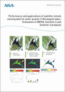
| dc.description.abstract | In this work, five lakes have been evaluated for the purpose of including satellite remote sensing products in water quality monitoring. Atmospheric correction has been performed and in-water products have been calculated, and the results are analysed in comparison with in situ data. The work shows that additional optical measurements are needed for a proper validation and for sound development of the remote sensing water quality products e.g. Chlorophyll-a (Chl-a). Still, Case2Regional CoastColour (C2RCC) products show promising results for the lakes investigated. A pixel-based average product of Chl-a, for example, shows the spatial variation within a lake which is a great add-on to the in situ classification and would otherwise be unavailable through conventional monitoring approaches. Challenges with dissolved organic matter absorbing in the same blue green spectra as chlorophyll needs careful consideration, and Chl-a products such as mean and yearly maps can be produced if the development of regional conversion factors are secured through additional sampling of the necessary parameters. | en_US |
| dc.description.sponsorship | Norwegian Environment Agency | en_US |
| dc.language.iso | eng | en_US |
| dc.publisher | Norsk institutt for vannforskning | en_US |
| dc.relation.ispartof | NIVA-rapport | |
| dc.relation.ispartofseries | NIVA-rapport;7443 | |
| dc.relation.ispartofseries | Miljødirektoratet-rapport;M-1579 | |
| dc.subject | Innsjøer | en_US |
| dc.subject | Lakes | en_US |
| dc.subject | Overvåking | en_US |
| dc.subject | Monitoring | en_US |
| dc.subject | Vannkvalitet | en_US |
| dc.subject | Water quality | en_US |
| dc.subject | Fjernmåling | en_US |
| dc.subject | Remote sensing | en_US |
| dc.title | Performance and applications of satellite remote sensing data for water quality in Norwegian lakes. Evaluation of MERIS, Sentinel-2 and Sentinel-3 products | en_US |
| dc.title.alternative | Ytelser og anvendelser ved bruk av fjernmålingsdata i overvåking av vannkvalitet for norske innsjøer. Evaluering av MERIS, Sentinel-2 og Sentinel-3 produkter | en_US |
| dc.type | Research report | en_US |
| dc.description.version | publishedVersion | en_US |
| dc.rights.holder | © Norsk institutt for vannforskning/Norwegian Institute for Water Research & Norwegian Environment Agency.
The publication can be cited freely if the source is stated. | en_US |
| dc.subject.nsi | VDP::Matematikk og naturvitenskap: 400 | en_US |
| dc.subject.nsi | VDP::Mathematics and natural scienses: 400 | en_US |
| dc.source.pagenumber | 63 | en_US |
| dc.source.issue | 7443 | en_US |
| dc.identifier.cristin | 1811616 | |
| cristin.ispublished | true | |
| cristin.fulltext | original | |
