| dc.contributor.author | Bekkby, Trine | |
| dc.contributor.author | Albretsen, Jon | |
| dc.contributor.author | Kuipers, Boele | |
| dc.contributor.author | Renaud, Paul Eric | |
| dc.contributor.author | Gundersen, Hege | |
| dc.contributor.author | Włodarska-Kowalczuk, M | |
| dc.contributor.other | Bekkby, Trine - Project manager | |
| dc.coverage.spatial | Svalbards vestkyst | nb_NO |
| dc.date.accessioned | 2018-01-22T08:47:33Z | |
| dc.date.available | 2018-01-22T08:47:33Z | |
| dc.date.created | 2018-01-02T14:47:16Z | |
| dc.date.issued | 2017 | |
| dc.identifier | 7137 | |
| dc.identifier.isbn | 978-82-577-6872-0 | |
| dc.identifier.issn | 1894-7948 | |
| dc.identifier.uri | http://hdl.handle.net/11250/2478605 | |
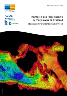
| dc.description.abstract | Dette prosjektet har hatt som mål å integrere, modellere og tilgjengeliggjøre marine grunnkart for Svalbard. Dyp, strøm, saltholdighet, temperatur, ulike terrengforhold (inkl. skråning, bassenger) og områder med skred og usortert sediment har blitt modellert og/eller avgrenset på grov skala (for hele Svalbard), på mellomskala (for utvalgte fjorder) og/eller på fin skala (for Kongsfjorden). Vi har sammenstilt data på tare og sedimentlevende dyr (infauna) og klassifisert hvilke områder i Kongsfjorden som mest sannsynlig egner seg for tarevekst og som potensielt kan ha over gjennomsnittlig høyt antall individer i sedimentene. | nb_NO |
| dc.description.abstract | Good information on coastal marine conditions is essential for management and planning. This project aimed to integrate, model and make available marine base maps for Svalbard. Depth, ocean current speed, salinity, temperature, different terrain types (incl. slope, basins) and areas of avalanches and unsorted sediment have been modelled/delineated at a coarse scale (for the entire Svalbard), at a medium scale (for selected fjords) and/or at a fine scale (for the Kongsfjord). We also integrated point data on kelp and sediment dwelling animals (infauna) and classified for the Kongsfjord in order to find areas most likely suitable for kelp growth and that potentially have an above average number of fauna individuals in the sediments. | nb_NO |
| dc.description.sponsorship | Svalbards miljøvernfond | nb_NO |
| dc.language.iso | nob | nb_NO |
| dc.publisher | NIVA | nb_NO |
| dc.relation.ispartofseries | NIVA-rapport;7137 | |
| dc.relation.uri | https://www.sysselmannen.no/globalassets/svalbards-miljovernfond-dokument/prosjekter/rapporter/2017/rapport---kartfesting-og-klassifisering-av-marin-natur-pa-svalbard.pdf | |
| dc.rights | Navngivelse-Ikkekommersiell-DelPåSammeVilkår 4.0 Internasjonal | * |
| dc.rights.uri | http://creativecommons.org/licenses/by-nc-sa/4.0/deed.no | * |
| dc.subject | Marine grunnkart | nb_NO |
| dc.subject | Marine basemaps | nb_NO |
| dc.subject | GIS | nb_NO |
| dc.subject | Modellering | nb_NO |
| dc.subject | Modelling | nb_NO |
| dc.subject | Svalbard | nb_NO |
| dc.title | Kartfesting og klassifisering av marin natur på Svalbard – et prosjekt for Svalbards miljøvernfond | nb_NO |
| dc.title.alternative | Marine mapping and classification on Svalbard – a project for the Svalbard Environmental Protection Fund | nb_NO |
| dc.type | Research report | nb_NO |
| dc.description.version | publishedVersion | nb_NO |
| dc.rights.holder | Norsk institutt for vannforskning / Norwegian Institute for Water Research | nb_NO |
| dc.subject.nsi | VDP::Matematikk og Naturvitenskap: 400 | nb_NO |
| dc.source.pagenumber | 26 | nb_NO |
| dc.source.issue | 7137 | nb_NO |
| dc.identifier.cristin | 1533928 | |
| dc.relation.project | Svalbards miljøvernfond: 2014/00143-2 (14/33) | nb_NO |
| dc.relation.project | 14200 | nb_NO |
| cristin.unitcode | 7464,20,11,0 | |
| cristin.unitname | Marin biologi | |
| cristin.ispublished | true | |
| cristin.fulltext | original | |


